The Floating Island of Derwentwater (Borrowdale)
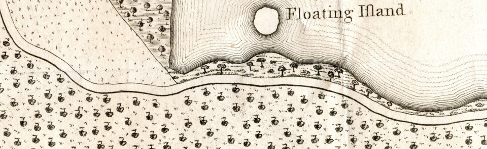
James Clarke, in his Survey of the Lakes of 1787 mentioned- and mapped - a strange phenomenon he had encountered off the south-east shore of Derwentwater – a Floating Island.
“This Island has its name from its sometimes being visible for a few days, and then becoming invisible for many weeks, or even months; at which time it is covered by water to a depth of two fathoms. It is worthy of remark, that the island is never visible unless the water in the lake be high, and then it scarcely appears more than a foot above the surface. This island is about twenty yards in diameter, nearly circular, and slopes gradually from the center to the circumference; and from thence, as far as the eye can distinguish the sloping is more sudden” (P.73).
Clarke went on to give an explanation, which he assumed (wrongly) to be due to an upwelling of water. Chet van Duzer has recently written about the occurrence of such islands worldwide, in his Floating Islands, A Global Bibliography, (Cantor Press, California, 2004). Usually, the cause of floating islands is decomposition of vegetable matter, making the island buoyant by the release of gases, with the island subsiding as the gases disperse.
In 1810, another floating island appeared in Tarn Wadling near Hesket in the Forest, which in the Middle Ages, had been associated with the legends of King Arthur
https://www.cumbriacountyhistory.org.uk/tarn-wadling-background-hesket-forest
Text by Bill Shannon
Extract of map of Derwentwater, Plate 6, James Clarke. Survey of the Lakes 1787
https://www.cumbriacountyhistory.org.uk/gallery/james-clarke-survey-lakes-1789-2nd-edn

