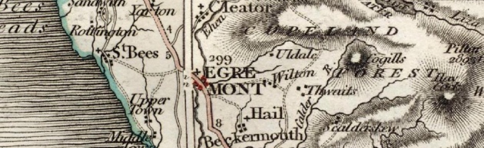
Egremont
Borough and ancient parish in Allerdale above Derwent ward, Cumberland. Parish also included mining villages of Bigrigg and Moor Row. Became Egremont UD 1894-1934. Minor boundary changes in 1890s transferred land at south end of borough from Lowside Quarter and St John Beckermet CPs to Egremont.
Acreage:
2,750 acres [1,113 ha], excluding small detached portion (26 acres [11 ha]) near Linethwaite, transferred to Hensingham CP 1882. Parish included extensive, scattered areas of common land (perhaps one-third of parish acreage) enclosed 1783, along with commons in Lowside Quarter and St John Beckermet.
Landownership:
Egremont castle was seat of barony of Copeland or Egremont, granted to William le Meschin early 12th century. Barony descended to his granddaughter Alice de Rumilly (d. 1186/7), coming to her grandson Richard de Lucy c.1200. On his death 1213 it passed to his daughter Mabel, wife of Lambert de Moulton and descended through Moulton family until death of John de Moulton 1334. Divided 1338 between his three sisters, who each obtained one-third of barony: Joan, wife of Robert Fitzwalter; Elizabeth, wife of Sir Robert Harrington; and Margaret, wife of Thomas de Lucy. Lucy share descended to earls of Northumberland (see Cockermouth), who obtained Fitzwalter share by exchange with other lands in early 16th century, and Harrington share in 1594. Barony then descended with honour of Cockermouth (q.v.).
Origins and growth of the town:
Borough established, literally at foot of castle, by lords of Copeland barony c.1200; market charter granted 1267. Borough byelaws refer to dyers, weavers and fullers, suggesting economy based on textiles. Iron mining (at ‘Thirnby’, in north of parish) recorded from c.1150 and across 13th and 14th centuries. Borough suffered in late-medieval period but was described as ‘good market towne’ by Sir Daniel Fleming 1675. Population estimated at 1,410 in 1688. 18th century saw beginnings of expansion of industry: there were four tanneries; 2 paper mills built mid-18th century; Greendyke flax mill built c.1760; High Mill (a flax mill by 1861) built as fulling mill 1760s. Population seems to have remained fairly stable, standing at 1,741 in 1821. Population boom began in 1850s: by 1861 it stood at 3,481, increase being attributed to ‘the opening of iron-ore pits and to the erection of flax mills’, and two more decades of strong growth followed, taking population to 5,976 by 1881. As well as iron mining (there were eleven mining companies in parish 1901) and flax/linen industry, limestone and freestone quarrying and lime-burning were carried out extensively in 19th century. Town continued to serve as market centre in mid-19th century, with cattle fairs and hiring fairs for servants at Whitsuntide and Martinmas. Most quarries and some iron mines had closed by 1900; most remaining mines closed in period 1914 to 1933. Egremont’s population declined from 1890s, fluctuating around 6,000 across first half of 20th century. Light industries replacing older extractive and manufacturing industries in 20th century included chocolate factory established by Rowntrees 1950 and carpet, shoe, bed headboard and handbag factories. Sellafield nuclear plant also provided employment. Population rose again from 1950s to peak of 7,996 in 1981. It stood at 7,444 in 2001.
Places of worship:
Church of St Mary (formerly chapel in St Bees parish) had gained parochial rights by 13th century; medieval church was rebuilt 1881-3. Site of medieval chapel, recorded 1338, preserved in field-name ‘Chapel Close’ in Brisco Mount area. Wesleyan Methodist chapel, Main Street, established 1821; replaced by new building 1876; still in use. Wesleyan Association Methodist chapel, Church Lane, built 1839; replaced by larger chapel, the United Methodist Free Church, Bookwell, built 1893; closed 1964; later used as Masonic hall. Primitive Methodist chapel, North Road, built c.1852; closed 1935; later used as rugby club house. St Bridget’s Roman Catholic mission school and chapel built 1872; replaced early 20th century by St Mary’s RC Church; in turn replaced by new building 1960. Cemetery to north of town, with mortuary chapels, established 1864. As Moor Row and Bigrigg grew in second half of 19th century, they acquired places of worship: church of St John the Evangelist, Bigrigg, built 1877-80. United Methodist chapel, Bigrigg, built 1862. Wesleyan Methodist chapel, Moor Row, built 1888; closed c.1957. Moor Row also had Primitive Methodist and United Methodist chapels.
Schools:
Petty school recorded 1722. School built and endowed by Thomas Benn (d. 1743), vicar of Millom; rebuilt 1844. In 1847 there were also four other day schools. Infant school established 1855 in former poor house; closed c.1870. Board schools built at Bookwell (1872; now Bookwell Primary School), Moor Row (1880; now Moor Row Primary School) and Bigrigg (1884; closed and converted to housing). Central Infant School, Main Street, built 1904; became girls’ junior and senior school 1920; then mixed senior school 1955; closed c.1964 when Wyndham School opened. Wyndham School opened 1964 as an early comprehensive community school; renamed West Lakes Academy 2008. Roman Catholic School built 1872-3; rebuilt on same site 1966; now St Bridget’s RC Primary School. Schools at Orgill (now Orgill Primary School) established 1998 to serve late-20th century housing developments west of town centre.
Other institutions:
Municipal buildings: Market Hall (used for concerts) built 1883; adjacent Town Hall built 1889-90. Mechanics’ Institution, with library, established 1846. Recreation ground beside river opened 1881.

