Dalton in Furness
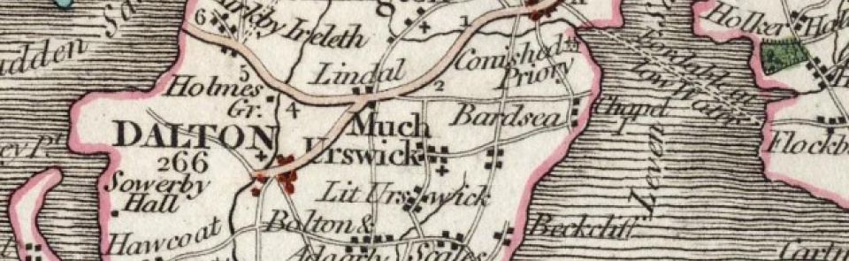
Ancient parish in Lonsdale hundred, Lancashire North of the Sands, covering much of southern end of Furness peninsula, and divided into four quarters or ‘bierleys’: Hawcoat, Yarlside, Above Town, and Dalton. Hawcoat and the bulk of Yarlside became part of new town of Barrow-in-Furness in 1867 (q.v.); from 1881 Dalton CP (UD from 1894 to 1974) consisted of divisions of Dalton Proper and Above Town (which embraced townships of Ireleth and Lindal & Marton). This entry covers Dalton Proper and Above Town, i.e. the three townships of Dalton, Ireleth and Lindal & Marton, each of which was reincarnated as separate CP in 1987 and is treated separately below.
Acreage:
ancient parish covered 17,962 acres [7,269 ha], of which 1,045 acres [423 ha] lay in Dalton Proper township and 5,362 acres [2,172 ha] in Above Town quarter, which comprised townships of Ireleth (4,196 acres [1,698 ha]) and Lindal & Marton (1,166 acres [472 ha]). Commons at High Moor, Low Moor, Stewner and Ireleth Marsh, Powka and Lindal Moor in Ireleth, Lindal and Marton (totalling c. 500 acres [c.200 ha]) enclosed 1831. Landownership: part of Furness Abbey’s manor of Plain Furness (see Barrow in Furness).
Population:
ancient parish contained population of 1,954 in 1801, rising to 3,231 by 1841. Rapid expansion of iron ore mining resulted in surge in population, including creation of new industrial settlement at Askam. By 1871 (from which time Barrow-in-Furness was enumerated separately) population of Dalton had risen to 9,902 and it peaked at 13,349 in 1881. Decline of mining industry resulted in slow decline to 10,339 by 1931. It remained at 10,913 in 1981 but growth of new housing saw increase to 12,799 by 2001.
DALTON
Modern CP of Dalton Town with Newton, established 1987, covers much of earlier division of Dalton Proper, together with Newton, which was formerly part of Yarlside quarter.
Origins and growth of the town:
Dalton was a borough and market town of medieval low Furness and seat of manorial government (Dalton Castle being court house and bailiff’s residence). Market charter granted 1239. In 1670s Sir Daniel Fleming described Dalton as ‘a good market for all kinds of provisions’, with Saturday market and fair on 12 October. Market declined from 18th century and was superseded by Ulverston but hiring fairs at Dalton continued to 20th century. Iron-ore mining recorded from 13th century; this remained small in scale in early 19th century, when Dalton contained hand-loom weavers as well as tanning, malting and brewing industries. Town grew rapidly in second half of 19th century with major expansion of iron mining after opening of Furness Railway 1846. Major iron mines in Dalton Proper were at Crossgates, Elliscales, Longlands and Mouzel. Mining at Newton from 1850s; last mine closed 1944. Limestone quarrying and lime-burning in 19th century. Light industries after Second World War, including Furness Footwear and Blair’s underwear factories (1948; closed 1983). By late 20th century, Dalton and surrounding villages had become dormitory settlements for Barrow. Some tourism, notably South Lakes Wild Animal Park, opened 1994.
Places of worship:
Medieval parish church of St Mary, Dalton, rebuilt 1825-6 and 1830; replaced by new building 1885. St Margaret, Ulverston Road, built 1904; taken over by Roman Catholics 1981. Methodist chapel above stable in Skelgate by 1823; replaced 1864 by new chapel in Wellington Street, still in use as Dalton Methodist Church. Primitive Methodist chapel, Ulverston Road, opened 1868; replaced by new chapel, Cleator Street, 1883. Old chapel used by Church of Christ early 20th century and by Seventh Day Adventists since 1987. Cleator Street chapel closed 1959; converted to housing. Bible Christian chapel (later United Methodist Church), Broughton Road, built 1872; closed 1935; later demolished. Congregationalists used former grammar school, Beckside Road, until chapel built 1869; now United Reformed Church. Baptists met in former Methodist chapel in Skelgate from 1868; chapel built at Broughton Road 1872; rebuilt 1885; closed 1963; now a bakery. Other places of worship included Plymouth Brethren and Welsh Calvinists (1874) who used old grammar school in Beckside Road. Roman Catholic chapel of Our Lady of the Rosary, built 1879; demolished after move to former Anglican church of St Margaret, 1981. Cemetery with Anglican and nonconformist mortuary chapels opened 1860; one taken over by Greek Orthodox Church of St Simon and St Kentigern, founded 1997. Mission room at Newton opened 1900, later called St Barnabas’ church; closed 1977 and converted to dwelling. Wesleyan Methodist chapel, Newton, opened 1891; closed 1965.
Schools:
Dalton free school founded 1622; survived into 19th century; then refinanced and rebuilt by local entrepreneurs, re-opening as church school (The Green School) 1862; closed 1969; replaced by new St Mary’s CE Primary School, Coronation Drive. Grammar school, Beckside Road, opened 1746; had closed by 1876. Board schools: boys’ school, Broughton Road, and girls’ school, Chapel Street, opened 1878 (latter now Chapel Street Infant and Nursery School). Roman Catholic school, Ulverston Road, opened 1880; replaced 1972 by Our Lady of the Rosary Primary School, Crooklands Brow. Junior mixed school, Nelson Street, opened 1884; became girls’ primary school 1928. Dowdales mansion, purchased by Lancashire County Council, opened as Dowdales Central School (now Dowdales School) 1928. Primary schools in Nelson Street (girls) and Broughton Road (boys) closed 1980 and replaced by new George Romney Junior School, Cobden Street. Mixed elementary school at Newton opened 1877; now Newton Primary School.
Other institutions:
Town Hall built 1884. Parish workhouse at Billingcote opened 1735; replaced by new workhouse at Goose Green 1826. Carnegie Free Library, Nelson Street, opened 1903. Empire cinema, Market Street, opened 1912; reopened as Roxy 1937; closed 1965. Electric Picture Palace in Co-operative Hall, Nelson Street, opened 1919, known locally as ‘Co-op pictures’; closed c.1960. Leisure complex, including swimming pool, opened 1987.
IRELETH
Modern CP of Askam and Ireleth, established 1987, covers approximately same area as former township of Ireleth.
Economy:
copper mine (disused by 1846); slate quarrying at Rebecca Hill. Major expansion of iron mining in mid-19th century at Roanhead (closed 1942) and Park mine (where what was then largest iron ore deposit known was discovered 1850; mine closed 1922). Ironworks established at Askam 1865; closed 1918 (site cleared 1933), limestone provided by new quarry at Goldmire. Brickworks established at Greenscoe 1845; still in operation. K Shoes factory at Askam (from1953; closed 1996) and British Cellophane factory at Sandscale (opened 1954; closed 1991). Wind farms at Far Old Park and Hare Slack Hill, built 1998-9. Population of Askam and Ireleth CP stood at 3,632 in 2001.
Places of worship:
medieval chapel of St Helen, near Chapel Hill, Haume (site recorded 1846). School at Ireleth licensed as chapel of ease 1637; building solely used as chapel after new school built 1778; rebuilt as St Peter’s church on new site 1865. Wesleyan Methodist chapel built 1870; replaced by new church nearby 1909; now shared by Methodists and Anglicans. Zion Primitive Methodist chapel built 1870; closed 1985; now converted to dwelling. United Methodist chapel (corrugated iron building) opened 1878; closed and became Rankin Hall social club. Christian meeting house of Church of Christ built 1907; closed 1956 and became St Anthony’s Roman Catholic Church, which closed 2009.
Schools and other institutions:
school at Ireleth, founded 1612 or 1624 by Giles Brownrigg of London; rebuilt 1778 and again 1862; now Ireleth St Peter CE Primary School. Senior mixed school, Askam, opened 1873; closed c.1973; now Askam & Ireleth Community Centre. Victoria Council School (mixed infants) opened 1887; rebuilt 1977, now Askam Village School. Temperance Hall, Ireleth, built 1872, used by Bible Christians in late 19th century; closed c.1907; renovated 1990s as community centre. Carnegie Library, Lord Street, Askam, opened 1904. Askam village hall (or Askam Lots Social Club) established c.1940s
LINDAL and MARTON
Modern CP of same name covers much of former township, though western boundary does not coincide with historic boundary with Ireleth and Dalton Proper.
Economy:
early mining attested by place-name Orgrave. Extensive limestone quarrying and iron mining by mid-19th century, with pits at Eure Pits, Lindal Cote, Lindal Moor and ironworks at Orgrave Mill, Poaka and Whitriggs (all ironworks closed before 1888). Further expansion of mining in second half of 19th century, especially on Lindal Moor. Mining declined in early 20th century; last mine to close was Margaret Mine at Henning Wood, Lindal, closed 1960.
Places of worship:
temporary iron church at Lindal built 1875 (later used as drill hall; destroyed by gale 1903); replaced by St Peter’s church, built 1885. Wesleyan Methodist chapels at Tarn Flatt, Marton (built 1866; closed 1960) and Lindal (built 1871; closed 1985). Christian meeting house, Lindal, built 1875; closed after Second World War.
Schools and other institutions:
school at Lindal built by Harrison Ainslie & Co. (iron mine owners) 1854; enlarged 1860; now Lindal and Marton Primary School. Buccleuch Hall built c.1875, used as Sunday school before becoming village hall. Reading room, Lindal, now a dwelling.

