Cumbria Domesday - Background General
The only part of Cumbria to be included in Domesday was the part around Ulverston and Dalton. The rest was not considered part of England
-until 1092 when William the Conqueror's son, William Rufus, took control of Cumberland and Westmorland
When the Domesday Survey was made on the orders of William the Conqueror in 1086, most of Cumbria was outside his realm - and North Lancashire was treated as part of the West Riding of Yorkshire.
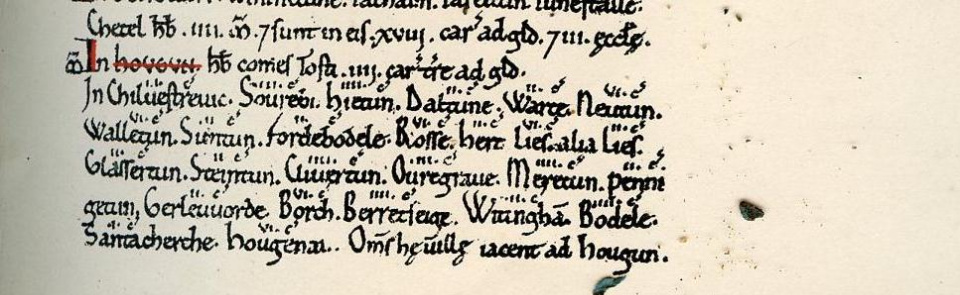
Places in the Furness peninsula were listed under the lost name of "Hougun", which was held by Earl Tosti, and rated at four carucates of land. The facsimile above lists other names including Sourebi (Sowerby), Daltune (Dalton), Rosse (Roose) and Glasserton (Gleaston). How many of the others can you interpret?
An Introduction to the Domesday Book can be found here And if you look up a place in 'About a Place', and it was mentioned in Domesday, there will be a link on the right hand side to a Domesday Book website, showing full details of the entry.
Image from a photo-zincographed facsimile of Domesday made by the Ordnance Survey in 1861
Posted by Bill Shannon

