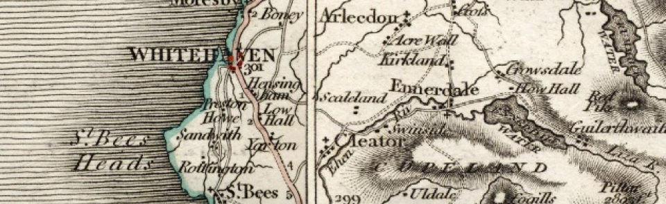
Whitehaven
Port and industrial town in St Bees parish, Allerdale above Derwent ward, Cumberland. This entry treats area of MB as established 1894, including Bransty, Harras and Corcickle areas and northern section of Preston Quarter. See also Hensingham.
Acreage:
Whitehaven township covered 176 acres [71 ha] before 1878, when boundary extended to include parts of Hensingham and Bransty. Extended further when became MB 1894, covering 1,813 acres [734 ha], including northern part of Preston Quarter CP, Bransty and Harras areas of Moresby CP and Corcickle and northern section of Hensingham CP. Further enlarged 1934 by absorbing parts of Moresby, Sandwith, Hensingham and Preston Quarter CPs.
Landownership:
part of manor of St Bees, passing to Crown on Dissolution 1539; granted to Sir Thomas Chaloner (d. 1565) 1553; most of manor bought by Thomas Wybergh 1599, who conveyed part to Lowthers; Wyberghs continued to hold an interest until bought out by Lowthers 1670 and 1684. On death of Sir John Lowther 1637, Whitehaven passed to his second son Christopher Lowther and descended to his son Sir John (d. 1706) (who rebuilt The Flatt as his seat) and grandson Sir James (d.1755). Passed to Sir James Lowther of Lowther 1756, who enlarged The Flatt, converting it into Whitehaven Castle; ownership descended thereafter through earls of Lonsdale.
Origins and growth of the town:
Whitehaven had been small harbour and fishing village from 13th century or earlier. Expansion began in mid-17th century with building of piers by Lowthers 1632-4 and 1679-81 and granting of market charter 1660. By 1680s it had grown rapidly, expanding from village of c.30 households in early 17th century to new town of over 1,000 inhabitants by 1685, which more than doubled to 2,281 by 1696. Sir John Lowther had laid out grid of streets by 1680s, making Whitehaven earliest planned new town in post-medieval Britain. Thomas Denton, writing 1688, recorded the ‘great encrease of trade within this twenty years; the houses being build of pure white stones ... the town running along the shore in a figure like an halfe moon, between the cliffe & Branstee-brow’. Trade was based on exports of coal from pits at Hensingham and Moresby, salt from saltpans at Bransty and Workington, grindstones from local quarries, and corn (oats and barley). Imports by 1680s included French wine and brandy; softwood, pitch and tar from Baltic; tobacco and sugar from West Indies. Peak of wealth came in 18th century, when, as well as supplying coal to Dublin, it was major port in Atlantic trade and leading tobacco-importing centre. By 1762 town contained 9,062 inhabitants. Though losing out to Liverpool in Atlantic trade from later 18th century, Whitehaven remained major coal port across 19th century. Several deep collieries were sunk: Saltom pit (first to mine coal under sea floor; sunk 1729; closed 1848); William pit (sunk 1804-12; closed 1965; site of major disaster 1947, when 104 killed); Wellington pit (sunk 1838; closed 1933; site of major disaster 1910 when 136 killed) and Haig pit (sunk 1914-18; closed 1986). Other important industries in 19th century included shipbuilding (shipyards at Bransty); sail-making (until 1931); pottery manufacture (until 1915; 3 potteries in Ginns area in 1840s); iron making (Newtown Foundry and Phoenix Foundry); fire brick manufacture; copperas/vitriol manufacture (established at Ginns 1718); flax spinning and linen manufacture, and bone manure works. Town’s role as regional centre reflected in publication of two major newspapers: Cumberland Pacquet, established 1774, and Whitehaven Herald, established 1830. Population continued to grow, rising from 10,628 in 1801 to 12,438 by 1821 and 14,190 by 1851. Long terraces of workers’ housing at New Houses built 1788. Population of area which became MB in 1894 remained fairly steady until after First World War, standing at 18,916 in 1851, 19,003 in 1891 and 19,535 in 1921. Town expanded onto higher ground to north (Bransty) and south (Kells) in later 19th/early 20th century, with new housing estates (associated with slum clearance) from 1930s. After decline of coal mining, Whitehaven acquired new industries. Marchon Chemicals, established 1941 (factory at Kells from 1943), initially manufacturing firelighters, soon specialised in soap powders, using local anhydrite (see Sandwith) and importing rock phosphate from Morocco from 1960s to 1990s; employed 2,250 in late 1970s; factory closed 2005 and demolished. H. Edgard, military uniform manufacturer, moved from London 1940; major employer, employing 580 in late 1970s. Quaker Oats company manufactured cereal at Beacon Mills from 1949 to 1972. Harbour closed for commercial purposes in 1990s, but developed as thriving marina. Tourist industry of growing importance to town’s economy from late 20th century.
Places of worship:
Chapel of ease by 1642; replaced by St Nicholas’ church, Lowther Street, built 1693; enlarged 1745; rebuilt 1883; nave and chancel destroyed by fire 1971, tower survives as chapel and community centre. Holy Trinity church built 1714; demolished 1949. St James’ church, Queen Street, built 1752-3; now town’s parish church. Christ Church: 1847-1977, demolished 2004 after a fire. St Peter’s, Kells, built 1938-9, replacing mission established 1908 and relocated 1920. St Mary’s, Mount Pleasant, built by Mr Hogarth 1789 but not consecrated; became Primitive Methodist chapels (see below, Hogarth’s Mission). First Roman Catholic church built 1761 in Chapel Lane; replaced by St Mary’s church, Duke Street, opened 1780; enlarged 1824; in turn replaced by St Bega’s church, Coach Road, built 1865-8. Older church of St Gregory, Coach Road, built 1835, became school when new mission church of St Gregory and St Patrick, Quay Street, opened 1890. Modern Roman Catholic churches at Kells (St Mary, built 1927; rebuilt 1960-1) and Mirehouse (St Benedict, built 1973-6). Protestant nonconformist presence from foundation of new town: Presbyterian worship from 1672; chapel (‘Low Meeting’) built 1695 for all Protestant Dissenters; enlarged 1749; renovated 1856; and rebuilt 1905; now United Reformed Church. Scotch Presbyterian ‘High Meeting’, Howgill Street, from 1755; then High Street from 1760 to 1895 (reopened later as Kirk Mission Hall – see below). Quaker meeting house, Sandhills Lane, built 1725; closed 1926; re-established in new meeting house (former Methodist Sunday school), Scotch Street; opened 1984; closed 2013. Congregational chapel (Providence Chapel), Duke Street, built 1793; enlarged 1838; moved to Scotch Street 1874; closed and demolished 1969 when URC Church formed, using former Presbyterian building. English Baptist chapel, Charles Street, built 1758; enlarged 1842; closed after 1851. Wesleyan Methodist chapel at Michael Street from 1761; closed because of subsidence 1791; used Hogarth’s Mission until chapel rebuilt 1795; rebuilt again 1818; closed 1877 and replaced by new church, Lowther Street, 1877; closed 1996. Primitive Methodists met in Hogarth’s Mission from 1828 and also had chapel in Fox Lane until 1859, when Howgill Street chapel built; closed 1940. Wesleyan Association (from 1858 United Methodist) chapel, Catherine Street, opened 1836; closed 1934 after Methodist reunification. Other places of worship established in 19th century included Christian Brethren (from 1854; moved to former Primitive Methodist chapel, Fox Lane, 1859; then to former Quaker meeting house, Sandhills Lane, 1931; still open) and Salvation Army (from 1878; moved to former Providence chapel, Duke Street, 1880; moved again to former United Methodist chapel, Catherine Street, 1937; rebuilt on same site 1971; still open). Non-denominational missions: Town Mission, Rosemary Lane, established 1862; rebuilt 1919; closed c.2015. Colliery Mission opened 1865; moved 1876 to former Glasshouse School, Ginns; apparently re-founded 1898; relocated 1960; still open. Holy Trinity Church ran mission at West Strand from 1885 to 1899, run by Wesleyans in closing years; re-opened 1899 in long-abandoned St Mary’s church (Hogarth’s Mission): although staffed by Wesleyans was technically independent until 1910; closed 1954 and demolished in slum clearance programme. Kirk Mission Hall (former Presbyterian chapel) opened 1905; united with Hogarth’s Mission 1908; became Wesleyan mission 1910; closed 1965. Ashkenazi Orthodox synagogue opened 1874; date of closure unknown. New places of worship in 20th-century include Primitive Methodist chapel, Kells (opened 1920; closed 1982) and Elim Pentecostalist church (founded 1957; church at George Street built 1961; closed 2012).
Schools:
Plot for school for new town laid out on north side of Lowther Street 1690s. Private schools included mathematics and surveying school taught by Andrew Pellin from 1690s and several private academies recorded across 18th century. Sunday schools important in providing schooling for working classes in earlier 19th century: Wesleyan Methodist Sunday school opened 1811; Sunday school at Ginns opened 1817. Provision of day schools expanded in early/mid-19th century: National school founded 1814; school built on Wellington Row 1824; became Elementary School 1874; rebuilt 1965; now St James’ CE Junior School. Marine School founded by Matthew Piper 1817; schoolroom built on High Street 1822; closed 1908. School at Ginns from 1818 (Infants) and 1845 (British School). Trinity School, Newtown, built 1837; replaced by Holy Trinity National School, Howgill Street, built 1852. St Nicholas School established 1846; enlarged 1874; closed 1911; replaced by Irish St School which later became Richmond Secondary Modern School and moved to former grammar school site, Catherine Street, 1969; closed 1980s. Colliers’ School converted from former glasshouse at Ginns 1853; replaced 1876 by Earl of Lonsdale’s School; enlarged 1922; now Monkwray Junior School. Market Place Refuge School, James Street, built 1852; enlarged 1859; replaced by Crosthwaite Memorial School 1901; closed 1985. National Infant school, High Street, built 1875; enlarged 1900; modified 1928; rebuilt 1965; now St James’ CE Infant School. County Secondary School, Catherine Street, opened 1908 on site bought with proceeds of sale of Marine School, becoming Whitehaven Grammar School 1948; moved to Hensingham (q.v.) 1968 where all secondary education now concentrated. In 20th century new schools built to serve housing estates at Bransty (1930), Kells Infants (1938), Kells Secondary Modern (1951; closed 1978) and Jericho (1969). Roman Catholic school at Ginns by 1847. School established 1868 in former St Gregory’s RC church, Coach Road; now St Begh’s Catholic Junior School. School at mission church of St Patrick & St Gregory, Quay Street, from 1889; rebuilt on new site 1960; now Ss Gregory & Patrick Catholic Community School. St Mary’s RC Primary School, Kells, built 1936.
Other institutions:
Customs house in 17th century on Custom House Street (later King Street); customs house, West Strand, built 1811. Market halls (one for fish; one for poultry, butter and eggs) built 1813; replaced by new market hall 1881. Public Office, Lowther Street (with court house on lower floor and newsroom on upper floor in 1840s) built 1807. Town Hall, Duke Street, converted from former mansion of Gale family (‘The Cupola’) 1851; replaced by Civic Centre, Lowther Street, built 1953; extended 1969. Copeland Borough Council offices, Catherine Street, built 2003-5. Town workhouse, Scotch Street, opened 1743; enlarged 1795 when it became female workhouse; male house built at Ginns in Preston Quarter. New Union workhouse south of town built 1854-5; closed progressively from mid 1930s, becoming Meadow View Geriatric Home; closed 1966 when services moved to new West Cumberland Hospital (see Hensingham). Dispensary, Queen Street, opened 1783; replaced by Infirmary, Howgill Street, opened 1830 and later extended; moved to Whitehaven Castle 1924 (former seat of Lowther family) until opening of West Cumberland Hospital at Hensingham (q.v.) 1966. Fever hospital at The Ginns in early 19th century. Smallpox hospital at Bransty, rebuilt 1895 for infectious diseases, open until mid-20th century. Almshouses (Aged Miners homes), totalling 31, opened progressively at Arrowthwaite, Kells, from 1926. Assembly rooms, Howgill Street, built 1736. Other 19th-century public halls included Temperance Hall (rebuilt 1859) and Oddfellows’ Hall, Lowther Street. Empress Ballroom, Duke Street, built 1933. Subscription library opened 1797 in Catherine Street, moving to Lowther Street 1808. Mechanics’ & Apprentices’ Library & Institution established 1825 but short-lived; reopened as Mechanics’ Institute, Queen Street, 1844, containing library, reading room and newsroom. Temperance newsroom, Tangier Street, established 1847. Free public library 1888; replaced by Carnegie Library, Catherine Street, built 1905-6. Modern library opened 1970. Library at Kells Welfare from 1933 to 1963; replaced by new library 1965. Kells Community and Miners’ Welfare Centre built 1939; demolished 1970s. Museums at Mechanics’ Institute, Duke Street, and in King Street by 1847. Museum at Whitehaven Natural History Society, Queen Street, 1867; moved to old Assembly Rooms, Howgill Street, 1874; then to former subscription library 1921; closed 1957 (building demolished 1961); museum reopened in Market Hall 1974, relocated to Civic Hall 1986, then to ‘The Beacon’ 1996. Theatre, Roper Street, built 1769; rebuilt 1909; screened films until 1931; demolished 1976. Films screened in Market Hall by 1908; renamed Palace Cinema during First World War; replaced by Queens Cinema, opened 1928; closed c.1976. Empire Cinema opened 1914 (in former Chapel Street theatre); closed 1963. Gaiety Cinema, Tangier Street, opened 1922; closed 2003; reopened 2015. Race course on Harras Moor by mid-19th century.

