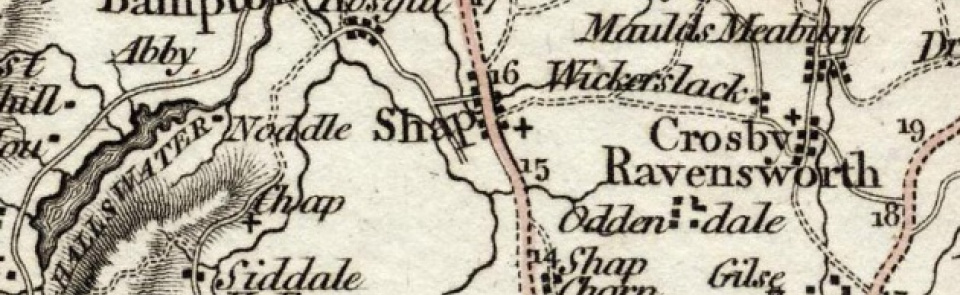
Shap
Ancient parish in West ward, Westmorland, including chapelries of Swindale and Mardale. Divided 1904 into Shap Urban and Shap Rural CPs; this entry treats whole of ancient parish.
Acreage:
27,177 acres [10,998 ha] before Shap Rural CP gained 159 acres [64 ha] of Crosby Ravensworth CP in 1935. Acreage includes extensive unenclosed fell commons of Ralfland Forest (3,838 acres [1,553 ha]) and Mardale Common (3,345 acres [1,354 ha]). Shap Common (2,463 acres [997 ha]) enclosed 1813; Shap rough intake (35 acres [14 ha]) in 1836; Wadshaw and Hazel Bank, Fawcett Forest (307 acres [124 ha]) in 1867.
Population:
rising across 19th century from 828 in 1801 to peak of 1,416 in 1881. Population of Shap Urban CP in range 1,000-1,200 across 20th century, standing at 1,221 in 2001. Population of Shap Rural CP fluctuated in range 250-400 in earlier 20th century, then declined to stand at 119 in 2001.
Landownership:
manor of Shap held by Curwens of Workington before being granted to Shap Abbey. At Dissolution passed to Lord Wharton and was later sold to Robert Lowther, from whom it descended to earls of Lonsdale. Mardale and part of Swindale lay in Thornthwaite Forest (see Bampton). Manor of Rosgill held by Rosgill family in 13th and 14th centuries, passing by marriage c.1362 to Salkeld family, who held it until 1631, when it passed by marriage to Christians, from whom it was purchased by Lowthers in later 18th century. Manor of Hardendale and Wasdale held by Byland Abbey (Yorks.), passed to Crackanthorpes of Newbiggin at Dissolution.
Economy:
village of Shap, strung out along main Kendal-Penrith road (A6) developed into small market centre: charter for market and 3 annual fairs obtained 1687; market hall built soon thereafter. Market and fairs had declined almost to extinction by mid-19th century. Boosted by arrival of Lancaster-Carlisle railway 1846, with station at Shap (station closed 1968). Market revived for farm produce, butter and eggs: new market house built 1861. Rural parts dominated by livestock farming and quarrying. Slate quarries by mid-19th century, at Thornship and Rosgill and at Mosedale (roofing slate quarried until 1920s). Granite quarrying, both pink granite in Wasdale (for building) from 1864 and blue at Wickersgill (for aggregate) from 1882, when Shap Silicated Granite Pavement Co. formed. Extensive limestone quarrying and lime-burning by mid-19th century. Large-scale commercial quarrying and lime works from 20th century: limestone quarry at Shap Beck opened 1930s; Shap Fell (or Hardendale) quarry opened 1962 with lime works nearby.
Places of worship:
Shap Abbey founded c.1201. Medieval parish church of St Michael; tower built 1828; rest rebuilt 1897-8. Keld chantry chapel founded c.1350. Chapel of ease at Mardale built 1596; consecrated for burials 1728; demolished 1937 on construction of Haweswater reservoir. Chapel of ease at Swindale recorded 1703; rebuilt 1749; restored and re-opened 1874; closed 1937. Quaker meeting house in Shap built 1704; closed by 1778. Wesleyan Methodist chapel, Shap, built 1845; rebuilt 1935; closed 2009.
Schools and other institutions:
school taught in parish church in 1703; separate schoolhouse built by 1815. Replaced by parish school for boys built 1838; Board school for girls and infants opened 1882; these combined 1955 on site of boys’ school; now Shap Endowed CE Primary School. Former girls’ school site became Shap Secondary School, open from 1955 to 1970. Endowed school attached to Swindale chapel founded 1703; still in use in 1898. Board schools at Rosgill (opened 1878; closed 1955) and Wickersgill (opened 1882 for children of granite quarry workers; closed 1960s; converted to dwelling c.2009). Workhouse for West Ward Poor Law Union built 1877; had closed by 1924; later used as children’s home, then sold to Shap Granite Co. for housing. Reading room opened 1872; enlarged 1924 as Memorial Hall. Former secondary school became magistrate’s court 1970; then youth centre and now Shap Library. Library and reading room at Mardale in late 19th century.

