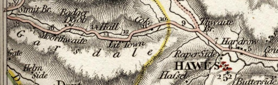
Garsdale
Chapelry and township in Sedbergh parish, Ewecross wapentake, West Riding of Yorkshire.
Acreage:
12,172 acres [4,926 ha], including extensive fell commons, parts of which were enclosed 1859. Baugh Fell (part of Bluecaster Common (7,556 acres [3,058 ha]), straddling boundary between Sedbergh and Garsdale) remains unenclosed.
Population:
rising from 571 in 1801 to peak of 911 in 1871 during building of Settle-Carlisle railway; then steady decline to 202 in 2001.
Land ownership:
manor of Garsdale belonged to St Agatha’s Abbey, Easby, which leased it to Scropes of Castle Bolton. After Dissolution, sold to Sir William Garway 1621, who sold it on to five Garsdale yeomen. Braithwaite Otway of Ingmire Hall bought up the five parts and enfranchised tenants1740. Grisedale was part of manor of Ravenstonedale (q.v.).
Economy:
predominantly hill farming, with hand-knitting. Coal mining on Baugh Fell and quarrying (sandstone, limestone, and ‘marble’), mid-19th century.
Places of worship:
church of St John the Baptist, chapel of ease to Dent, recorded mid-16th century; rebuilt 1861. Quaker meeting houses at Birkrigg in Garsdale (house bought 1703; closed 1900) and Stubstacks in Grisedale (built 1706; closed 1870, then used by Methodists; demolished c.1888). Protestant dissenters had chapel in mid-18th century. Wesleyan Methodist chapel, Low Smithy, built 1830 or 1831; still in use. Primitive Methodist chapel, Garsdale Street, built 1841; still in use. Mount Zion Chapel (Methodist), Garsdale Head (otherwise called Hawes Junction), opened 1876; still in occasional use. Further Wesleyan Methodist chapels at Garsdale Foot (built 1864; closed 1979) and Grisedale (built 1889; closed 1970).
Schools and other institutions:
school endowed by Thomas Dawson 1634; rebuilt as National school on new site, 1842, becoming Garsdale Primary School; closed 1985; converted to village hall.

